April 19, 2023
New ✨
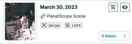
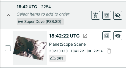
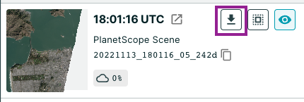
- It is now easier to preview and order imagery. When you search for imagery, you will see three new buttons. Click X items button to check out each satellite image from that date and make the best choice. Click the eye button to preview the imagery from that date on the map. Click the cart button to add the imagery to your order. You can select and de-select imagery from multiple dates. You can also lock the footprint of an image onto the map to get a better sense of coverage.
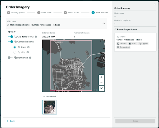
- When you place an order, there is a new option to composite images, which stitches them together. You will receive fewer files and consume less quota. Composite all will give you one file and composite by strip will provide the most consistency (spatial, spectral, environmental, etc). Take a look at the impact of each option on the map to get a sense of what you will receive.
- You can now more easily use your Hosted Data in other tools and platforms. Download the Cloud Optimized GeoTIFF (COG) and pull it into other web applications at no extra cost.
Improvements 🙌🏻
- You can now select MGRS as a format in Settings, under the Coordinate System section. You can also easily copy MGRS coordinates out of Explorer to paste into other systems. The coordinates can be found in the bottom banner of the app. Please note: precision varies by the zoom level and resolution.
March 23, 2023
Improvements 🙌🏻
Composite orders with multiple product bundles are no longer supported
To ensure a more streamlined process and reduce the occurrence of failures, we have decided to discontinue support for composite orders that contain multiple product bundles. This change prevents downstream failures, resulting in a more efficient and reliable process. Going forward, users cannot submit composite orders with multiple product bundles, but must submit only one order per product bundle.
February 16, 2023
Planet QGIS Plugin Version 2.3 Updates
Improvements 🙌🏻
- An area estimate is displayed when you draw an area of interest to search for Basemap quads to download.
- STAC metadata is now available as an option when placing an order.
- A new Add to Map button is included in the Orders panel. When Add to Map is selected, a true color visualization of PlanetScope or SkySat imagery is automatically rendered in the QGIS map.
- An improved multi-polygon search has been added. You can now search for individual polygons in a multi-polygon or select a bounding box around the multi-polygon extent.
Bug Fixes 🐛
- The auto-fill coordinates feature now correctly completes fields in the Tasking Dashboard and a location is specified in the Tasking panel.
- The Basemap series cadence is now in the correct sequential order.
- The metadata fields in imagery footprints now display the correct data type.