September 14, 2023
Updated Metadata if Using the Clip Tool in the Orders & Subscriptions API 🙌🏻
The Subscriptions API and Orders API update the contents of the metadata JSON file when the clip tool is used. Previously, the footprint in the delivered metadata was for the entire scene, even if the scene was clipped. Now, the footprint will be clipped to the clip Area of interest. Similarly, the UDM2 metadata values are now updated and relevant to the clipped Area of Interest. UDM2 metadata values are only updated if a UDM2 asset is included in the Orders bundle or Subscriptions "asset_list".
August 30, 2023
New ✨
Path Prefix Support for the Subscriptions API
You can now use the path_prefix parameter in the Subscriptions API when you deliver subscriptions to one of our supported cloud storage providers. This is an optional string that will prepend to the files delivered to the bucket.
August 29 2023
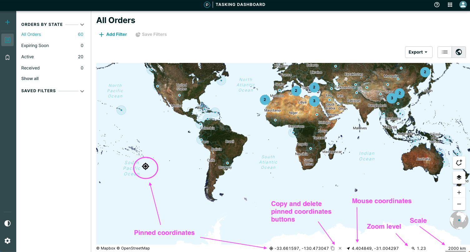
Tasking Dashboard Updates
Improvements 🙌🏻
- Similar to Explorer, a status bar visible on the Map view is now available and contains:
- Attribution / copyright
- Pinned coordinates that is visible upon click anywhere on the map. These coordinates can then be optionally copied or deleted.
- Mouse coordinates
- Zoom level
- Scale
August 16, 2023
New Vertices Support for the Subscriptions API 🙌🏻
You can now use geometries with up to 1,500 vertices in the Planet Subscriptions API.