December 08, 2022
Improvements 🙌🏻
- The Import Dialog is updated to provide improved validation and assistance when a geometry needs to be simplified.
- If you upload a multi-feature file (multiple geometries in one file), all features display on the map. You can easily inspect your selections with a geo reference instead of a thumbnail. You can choose to select or deselect all.
- If your geometry contains more than 500 vertices or if it contains self intersecting points, you are presented with simplified alternatives. These alternatives are supported when selected.
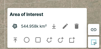
- Measurements no longer display as abbreviating measurements. For example, 1,500 km2 instead of 1.5k km2.
Bug Fixes 🐛
- This release fixed an issue when moving Hosted Data items to folders. Now only selected data is moved.
- There were issues reordering past orders that were not clipped. Now you can now reorder without issues.
November 16, 2022
Improvements 🙌🏻
- You can now clip Hosted Data orders if you have clipping permissions.
- You can re-order a previous order from the Orders tab.
- When searching for a specific address, a pin marker indicates a single point at the searched location.
Bug Fixes 🐛
- When in compare mode, compare cards did not correctly display the timestamp.
- Searching for locations could result in a default selection of the first item in the result list instead of the desired selection from the list.
October 06, 2022
Draw and Measurement Tool Improvements 🙌🏻
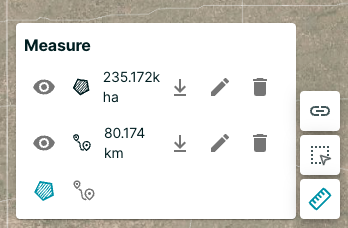
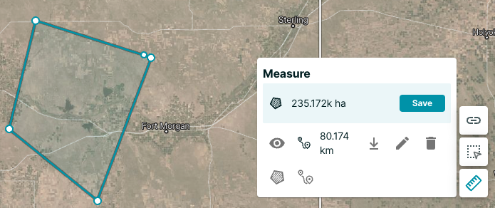
There are improvements to the draw and measurement tools in Planet Explorer. By default, you can view the size of your area of interest. You can also edit and download each drawn geometry, including the area of interest and the measurements.
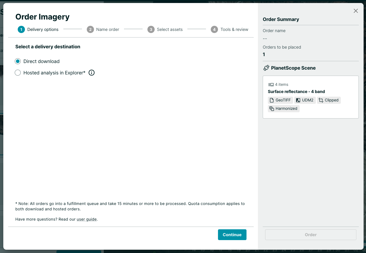
The orders steps are consolidated and you can now choose between "Direct Download" or "Hosted Data" on the first step of the dialog.
October 3, 2022
New ✨
Orders API now supports Planet Basemaps
With the Orders API, users can now apply raster tools like clip, bandmath, reproject, and merge to Planet Basemaps, and have them delivered along side with sourcetrace and UDM2 metadata to Planet’s support cloud storage locations.
Customers who have a plan that enables access to Planet Basemaps can take advantage of this new feature. NICFI Basemaps can only be ordered from the Orders API by those with Level 2 NICFI access.
Read more about Ordering Basemaps.