Tasking Dashboard
The Tasking Dashboard is a graphical user interface that streamlines order submission and management. The Tasking Dashboard also provides the ability to preview the image captures taken for orders.
NOTE
The Tasking Dashboard is optimized for Desktop browsers only, currently only Chrome and Firefox.
Quota Usage
There are several available methods to track estimated quota usage and availability:
- From the Planet Account Page, you can view the quota bars for tasking quota usage, and run Quota Usage reports. Manage Your Account provides complete details.
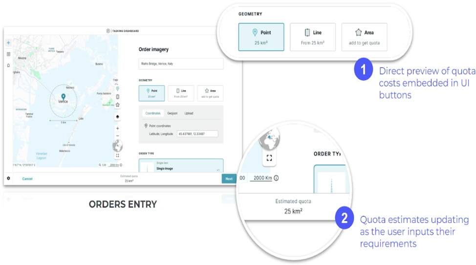
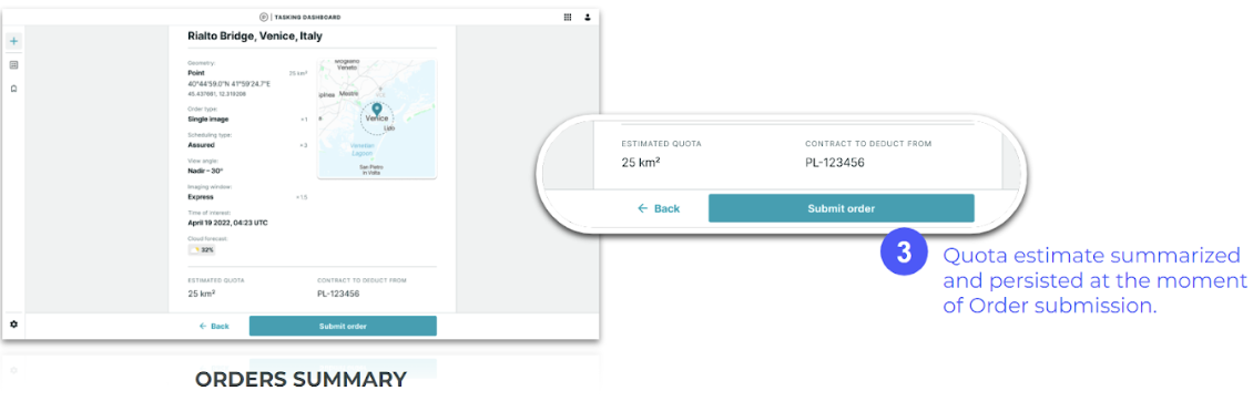
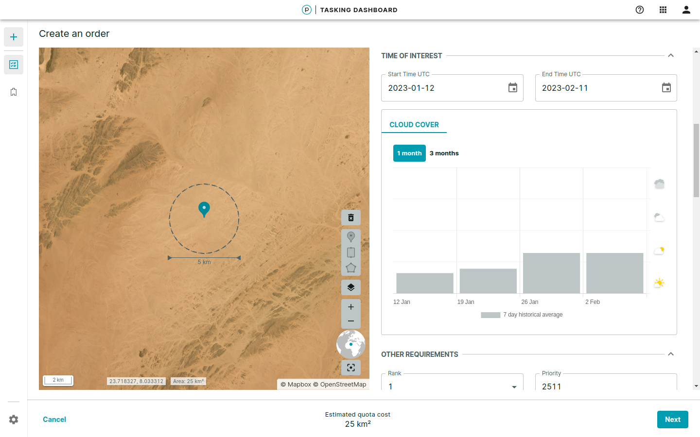
- As you enter a tasking order, a quota preview displays the estimated quota in sq km directly in the Tasking Dashboard Order Summary. Quota estimates are dynamically updated as you input and adjust requirements.
Order Entry
By inputting various parameters in the Order creation windows, you can create any of the following order types:
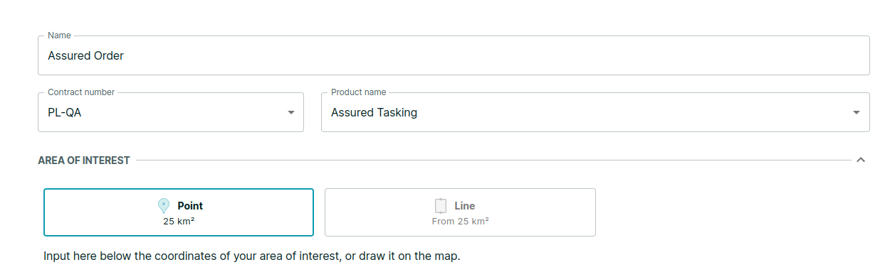
- Point
- Line
- Area
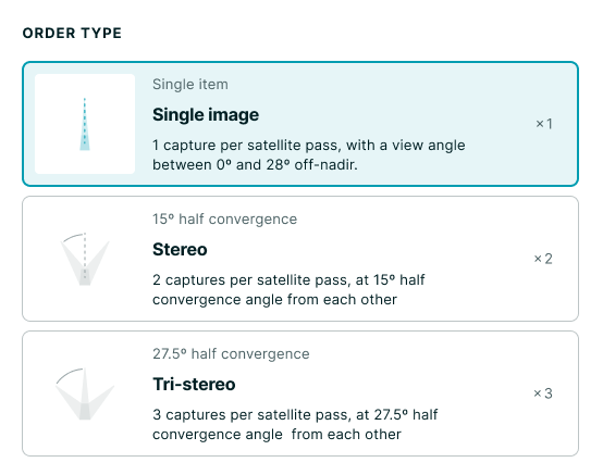
In the Tasking Dashboard > Create an Order > Other Requirements, the Order Type selections are:
- Single image, available for Point, Line and Area orders
- Stereo, available for Point and Line orders
- Tri-stereo, available for Point and Line orders
NOTE
During order entry, you can start over with an area of interest (AOI) by using the Trash icon at the top of the toolbar. The geometry is removed so you can create a new AOI.
Point Order
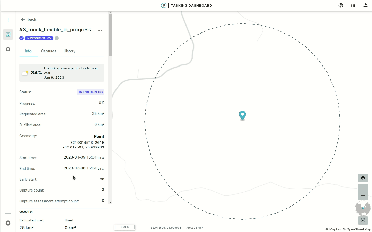
Point orders capture a specific point and a 2 km radius circle is automatically added to your coordinates representing the guaranteed collection area.
Line Order
Line orders capture a rectangular area and a 5 km wide strip that is a maximum of 100 km long.
Area Order
Area orders capture any form of an area. If the area is too large to be captured all at once, the area is tessellated into smaller strips.
NOTE
Area orders less than 25 sq km are charged for a default minimum of 25 sq km if fulfilled.
Flexible Order
A flexible order purchases SkySat capacity at various areas of interest (AOI). There are no guarantees on the delivery timeframe. The duration is measured from the start date to the end date of the time of interest (TOI). The order must be at least 14 calendar days and must be placed at least 24 hours before the TOI start date.
NOTE
To avoid being charged for unwanted fulfilled captures, ensure that you cancel scheduled flexible tasking orders at least 24 hours before the originally scheduled capture time. Orders canceled with less than 24 hours notice are charged for fulfilled captures.
To create a Flexible order, at least 24 hours before the TOI start date:
- Select Flexible Tasking as the product name.
-
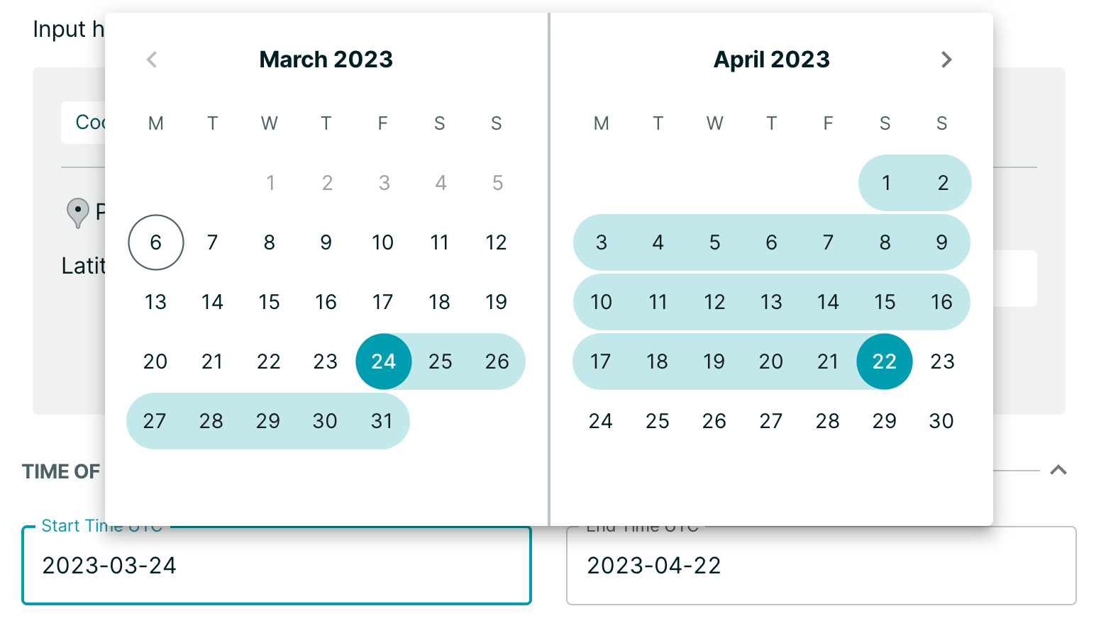
In the date picker, select the date range for your imagery search results. Select the dates to filter your search for one or more date ranges. The dates are UTC by default. Be sure to set the end date to a date at least 14 days in the future from the start date.
-
Set the following values (required):
- Geometry type
- AOI
- Order type (image or stereo)
- Off-nadir angle
A maximum 30º off-nadir Angle (ONA) applies to all orders. This enables Planet to maximize fulfillment and deliver as many high quality captures as possible.
-
To change the duration of an existing flexible order, change the values of the date-time calendar on flexible orders by hovering over the date and selecting the checkmark.
NOTE
The start date can only be changed if the order is pending. The end date can only be changed if the order state is pending or in progress.
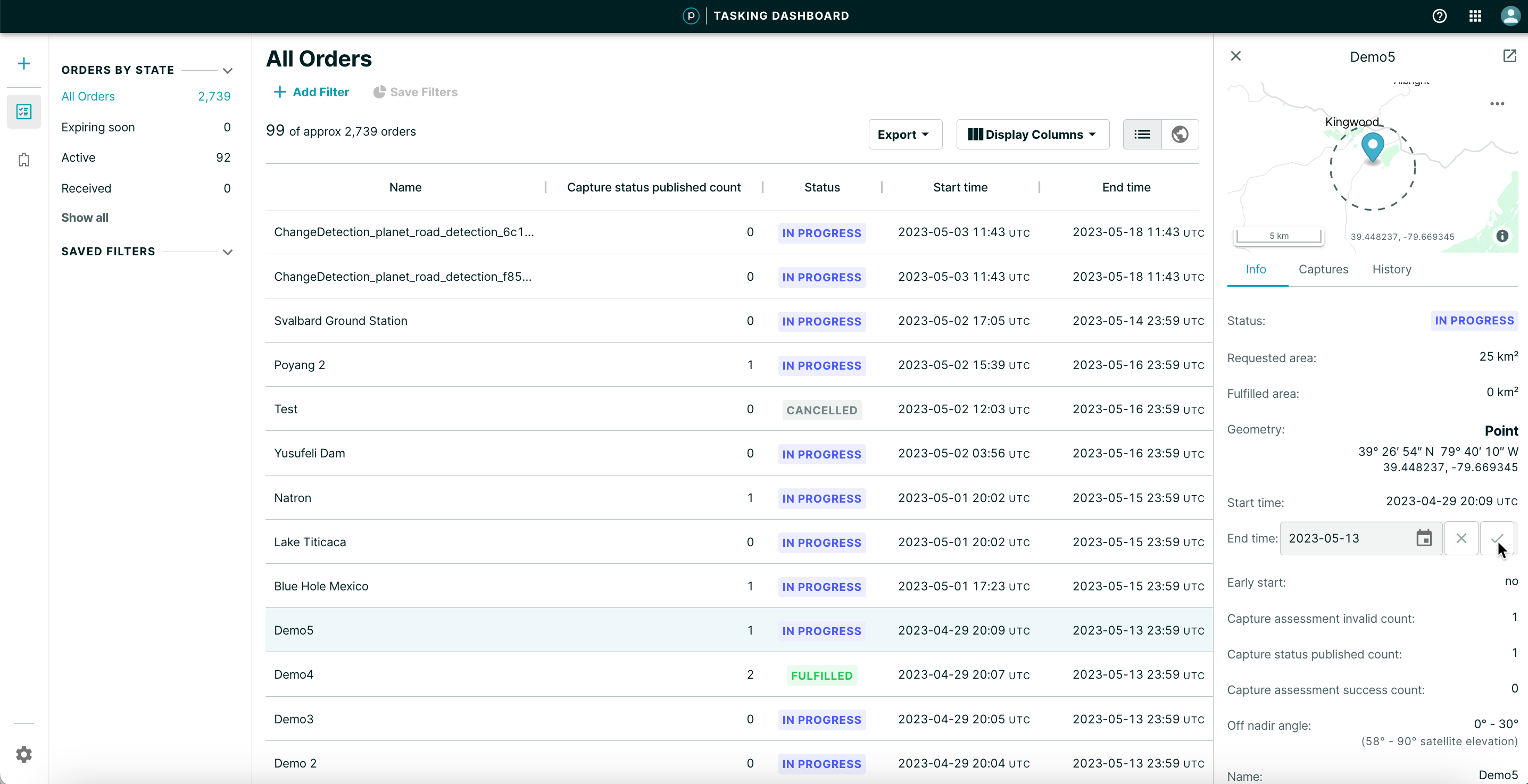
You can also change the date in the order detail view when you select it from the orders list:
- Hover over the date-time field and select the pencil icon.
- Change the date-time.
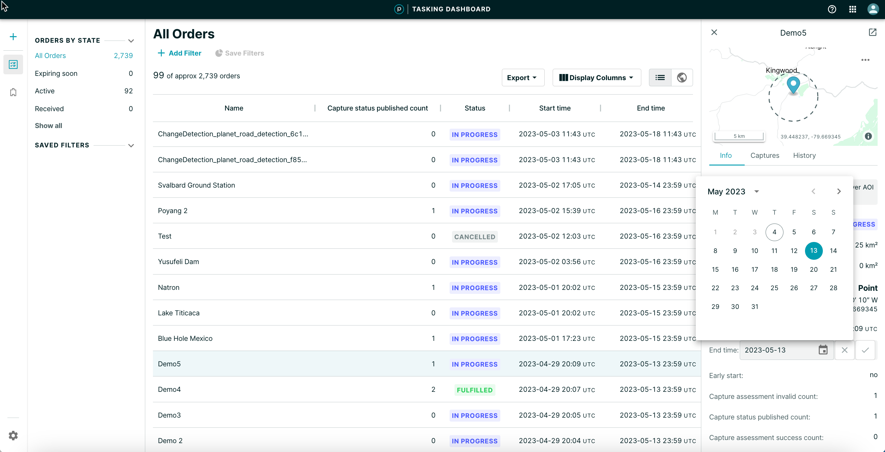
- Confirm by selecting the checkmark icon.
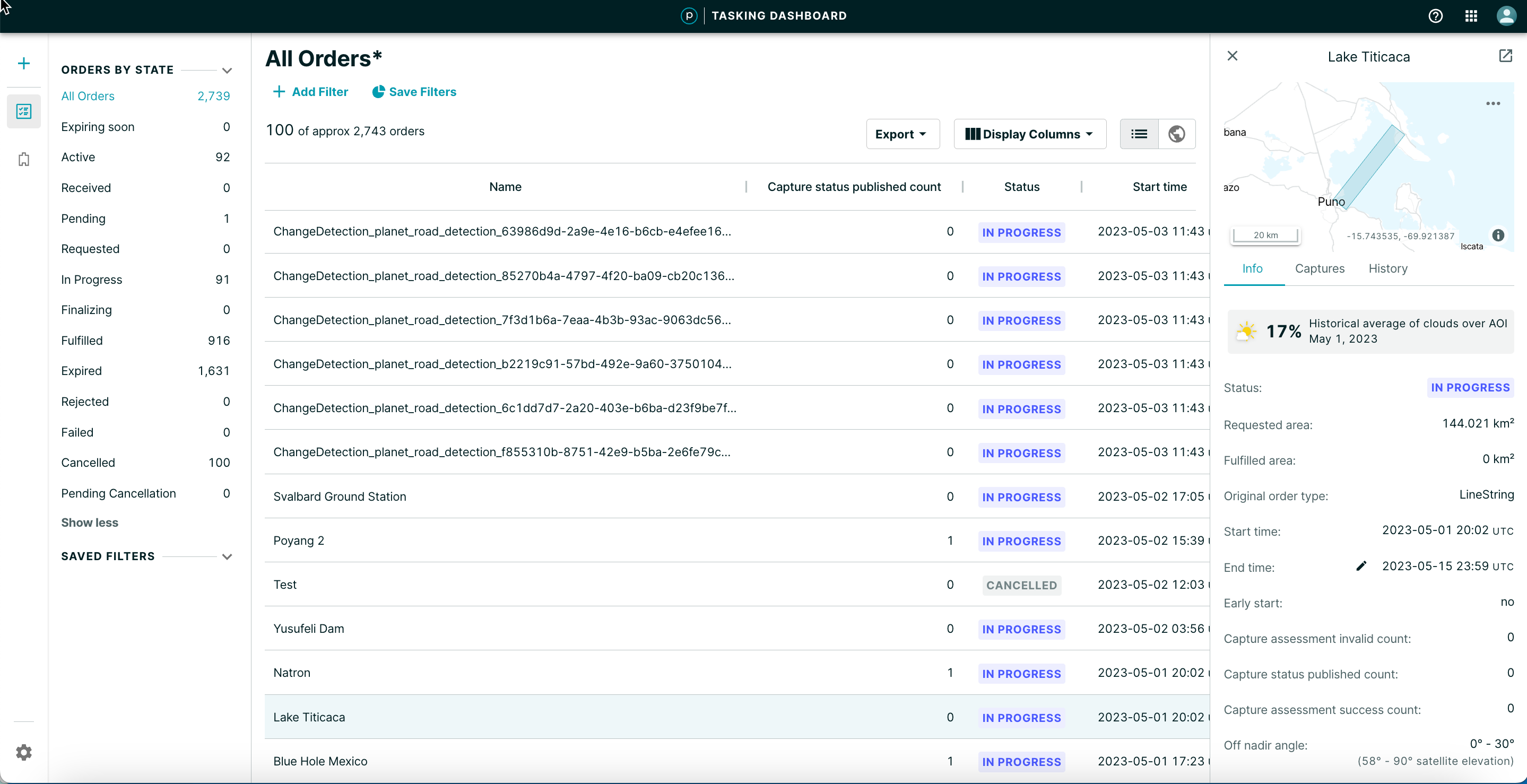
Historical Cloud Coverage
Flexible orders introduce the seven-day historical average of cloud coverage. This additional adjustment can increase transparency and improve order delivery. You can filter the data for one month, three months, six months, or one year.
NOTE
Not all time periods are available. Hover over a bar in the Cloud Coverage chart to view the seven-day average value. The lowest value represents the lowest seven-day average historical cloud cover in the order AOI.
Assured Tasking Orders
Assured Tasking orders are assured to occur at a specific time and date for a satellite while it is scheduled to be over the specified geo-coordinate. If the timeslot is within six hours, the order is set to Express and costs 1.5 times more than a normal Assured order.
NOTE
Assured tasking orders can not be canceled with less than 24 hours notice. To avoid charges for unwanted fulfilled captures, ensure that you cancel assured orders more than 24 hours before the originally scheduled capture time.
-
Select Assured Tasking from the Product name field.
-
Select an imaging window for an assured order.
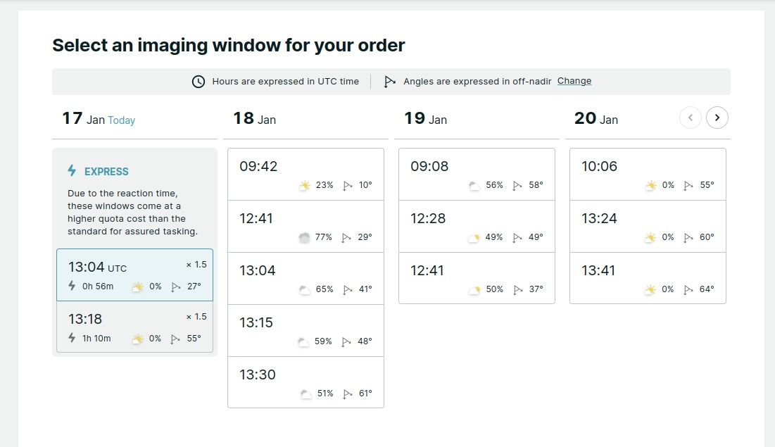
In the Order Summary, Assured tasking is listed under Scheduling type.
Stereo Order
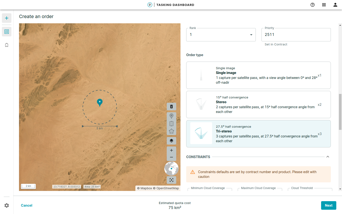
Stereo orders take two or three captures of the same point in one order.
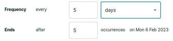
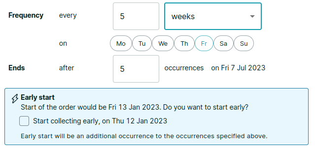
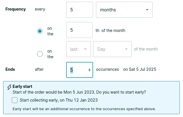
Monitoring Order
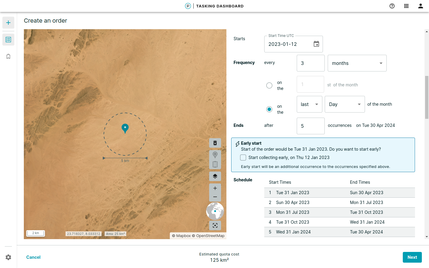
Monitoring orders capture the same point over a series of time. Available options are days, weeks and months for configuring the temporal resolution.
You can also generate an additional occurrence between now and when the order is scheduled to start.
Off-nadir Angles
A maximum 30º off-nadir Angle (ONA) applies to all orders by default. This enables Planet to maximize fulfillment and deliver as many high quality captures as possible. Off-nadir angle warnings indicate values that are difficult to schedule or can result in image capture failures.
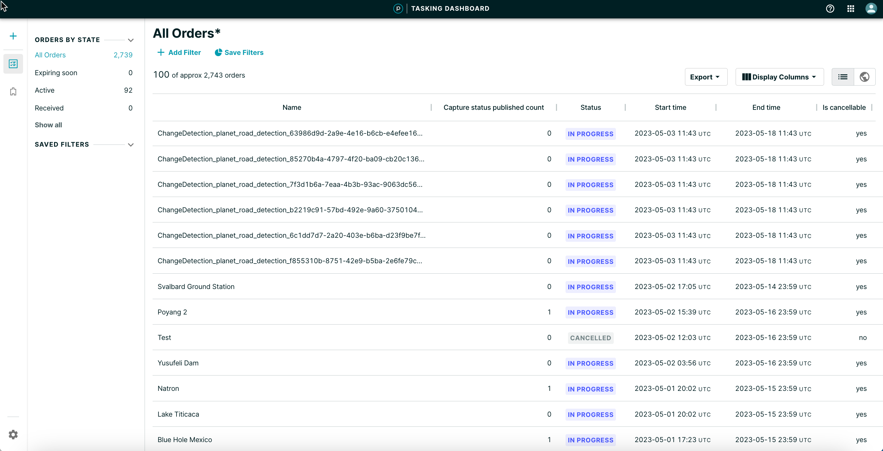
Order Progress
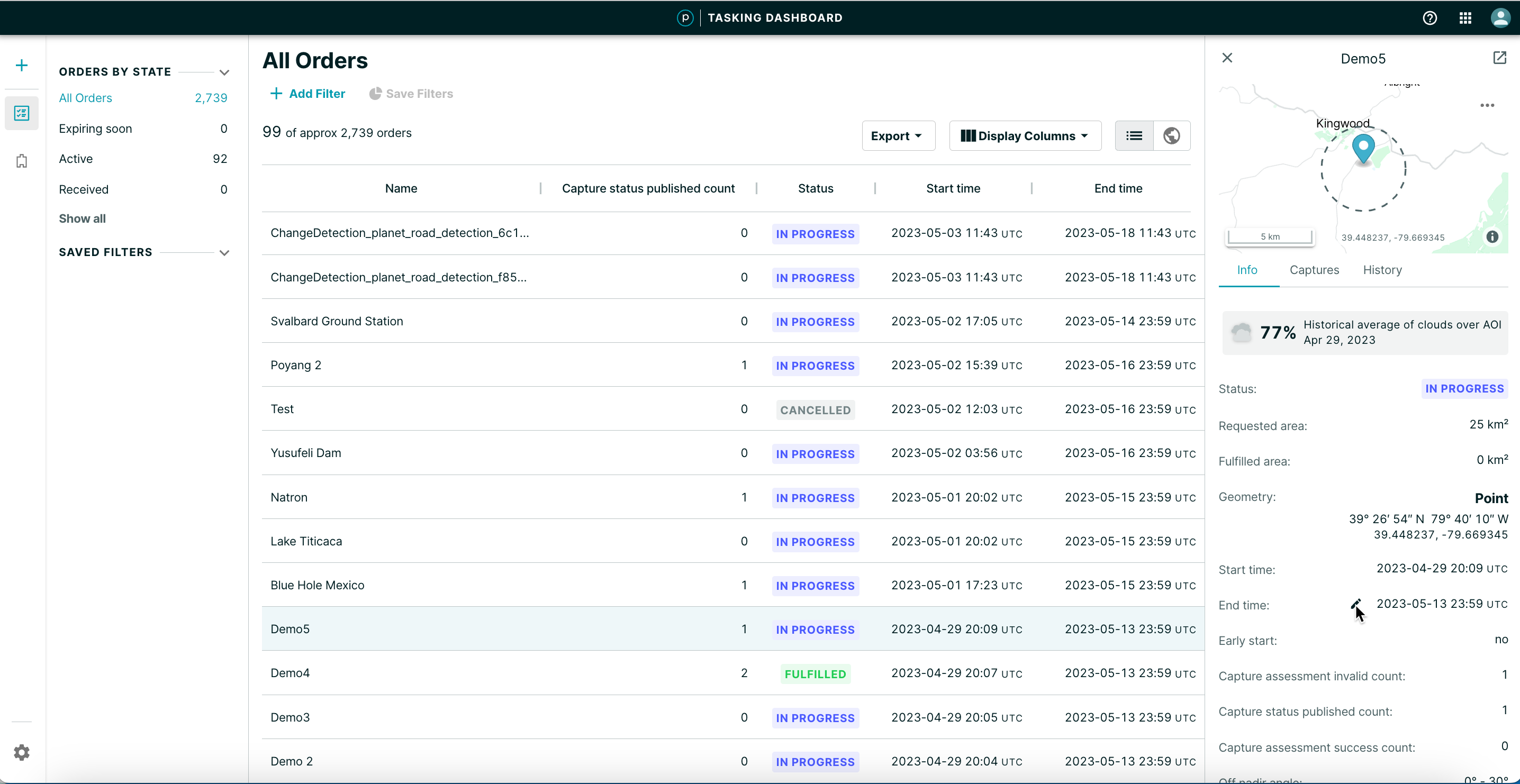
View the order status in the All Orders table view or the map view.
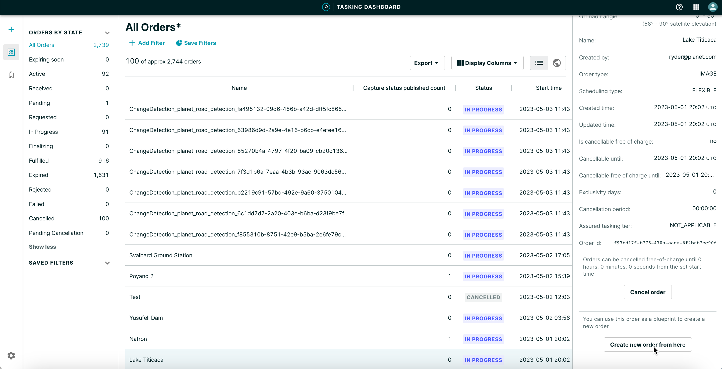
Order Progress - Table View
Order Progress - Map View
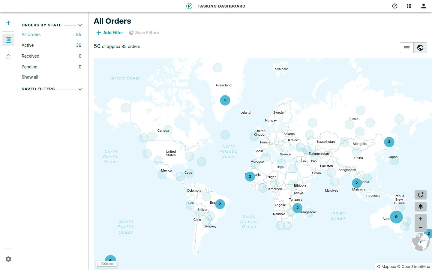
In the map view, orders are clustered together initially, until you zoom in and the clusters disperse into the individual order geometries. Clicking on an individual order opens the order flyout in the right panel with more detailed information.
- Switch between the table view and the map view by using the control at the top right of the window.
- Filter by the current map view or by a manually-drawn geometry.
- Manually draw a geometry by opening the Draw polygon filter dialog and selecting the top control in the bottom right corner of the map.
After using Select viewport or drawing a polygon in the map, click ADD AS FILTER to apply the filter. The same filter is applied to the table view.
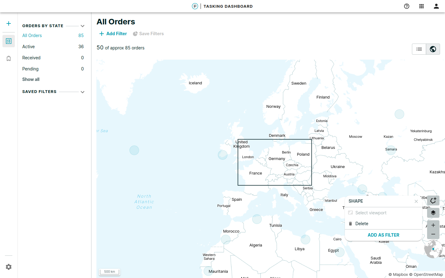
To remove the geographic filter, use the Delete option from the dialog or click X on the Geometry filter option.
Order View
In the table view, customers can drill deeper into individual orders to review the configuration and status for each order.
NOTE
You can track expiring Flexible orders with the new Expiring soon filter in Orders by State.
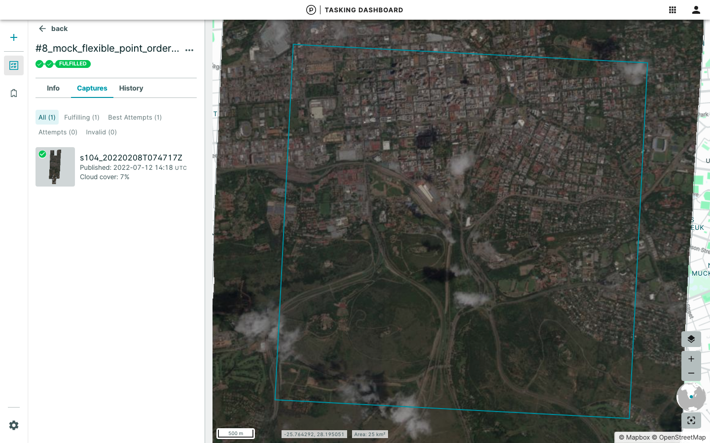
The Order Detail view can be expanded to display captures made for each order. Each capture page also provides a link to the image in Planet Explorer to download the imagery assets. For point orders, a 25 sq km box is drawn around the area of interest.
Duplicating or Cloning an Order
You can use completed orders as blueprints for new orders, eliminating the need to re-input requirements and AOIs. All fields, with the exception of the TOI are copied to the order entry form.
Click Create new order from here and modify the fields in the form as required.
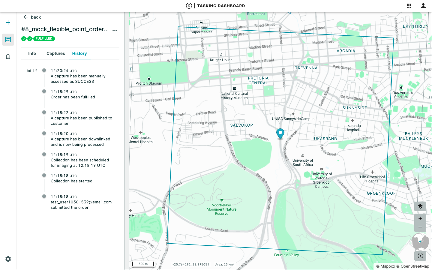
Order History
The History tab lists all of the events that occurred with an order. The events include order creation, order edits and order fulfillment for the timeline.
We are continually working to improve our technical documentation and support. Please help by sharing your experience with us.