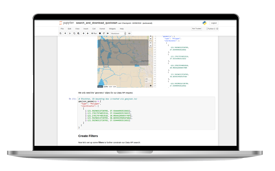
Documentation
Browse user guides, documentation and full API references for Planet's APIs, GIS Integrations, Imagery and Apps
- Data: search for, filter & download Planet imagery
- Analytics: Access analytic products derived from Planet imagery
- Basemaps: Access to Planet's mosaiced basemap services
- Tile Services: Planet's XYZ & WMTS tile protocol services
- Tasking: Create, edit, cancel and manage SkySat point collection orders
- Orders: Create processing pipelines with analysis-ready data
- Subscriptions: Subscribe to continuous cloud delivery of imagery
- Reports: Download usage reports

Level up at Planet School
Follow in-depth guides and hands-on tutorials at Planet School: level up the skills you need to get the most out of Planet's platform
What's New
New ✨
(Beta) Subscriptions API Google Earth Engine Delivery
A new delivery block google_earth_engine
is now supported. This integration allows you to create a subscription that will automatically deliver new imagery to your GEE account as it becomes available. This integration works very similarly to the Orders API Integration.
Find out more here.
Updated Metadata if Using the Clip Tool in the Orders & Subscriptions API 🙌🏻
The Subscriptions API and Orders API update the contents of the metadata JSON file when the clip tool is used. Previously, the footprint in the delivered metadata was for the entire scene, even if the scene was clipped. Now, the footprint will be clipped to the clip Area of interest. Similarly, the …
Looking for help getting started with the Open Geospatial Consortium (OGC) API Tiles specification? This primer can get you going.
Planet’s new CLI has no builtin GIS capabilities other than what Planet’s APIs provide. To help make more sophisticated workflows possible, Planet is releasing a new package of command line programs for manipulating streams of GeoJSON features.