January 06, 2021
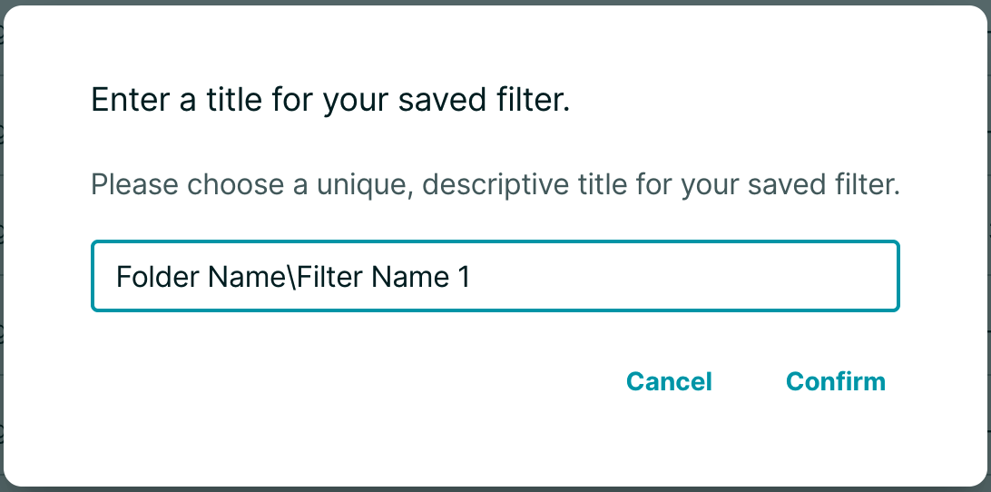
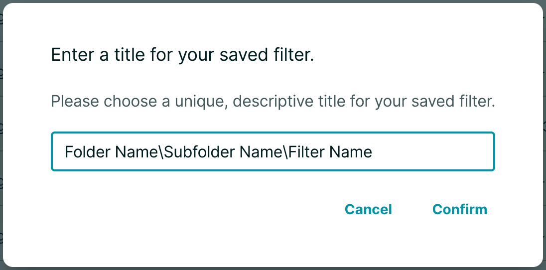
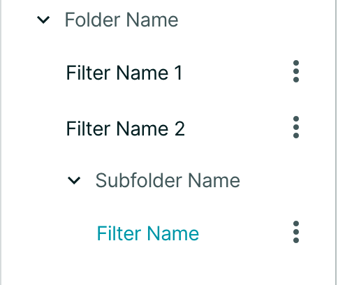
- "Folders" for saved filters: With the renaming function and backslashes ("\") you can now organize your favorite saved filters into neat folders:
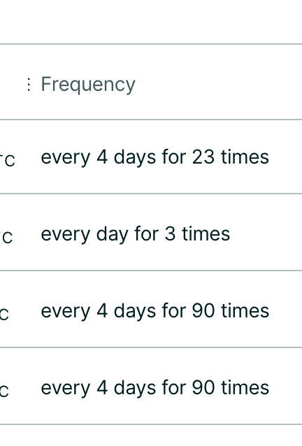
- Renamed 'recurrence' to 'frequency':
January 04, 2021
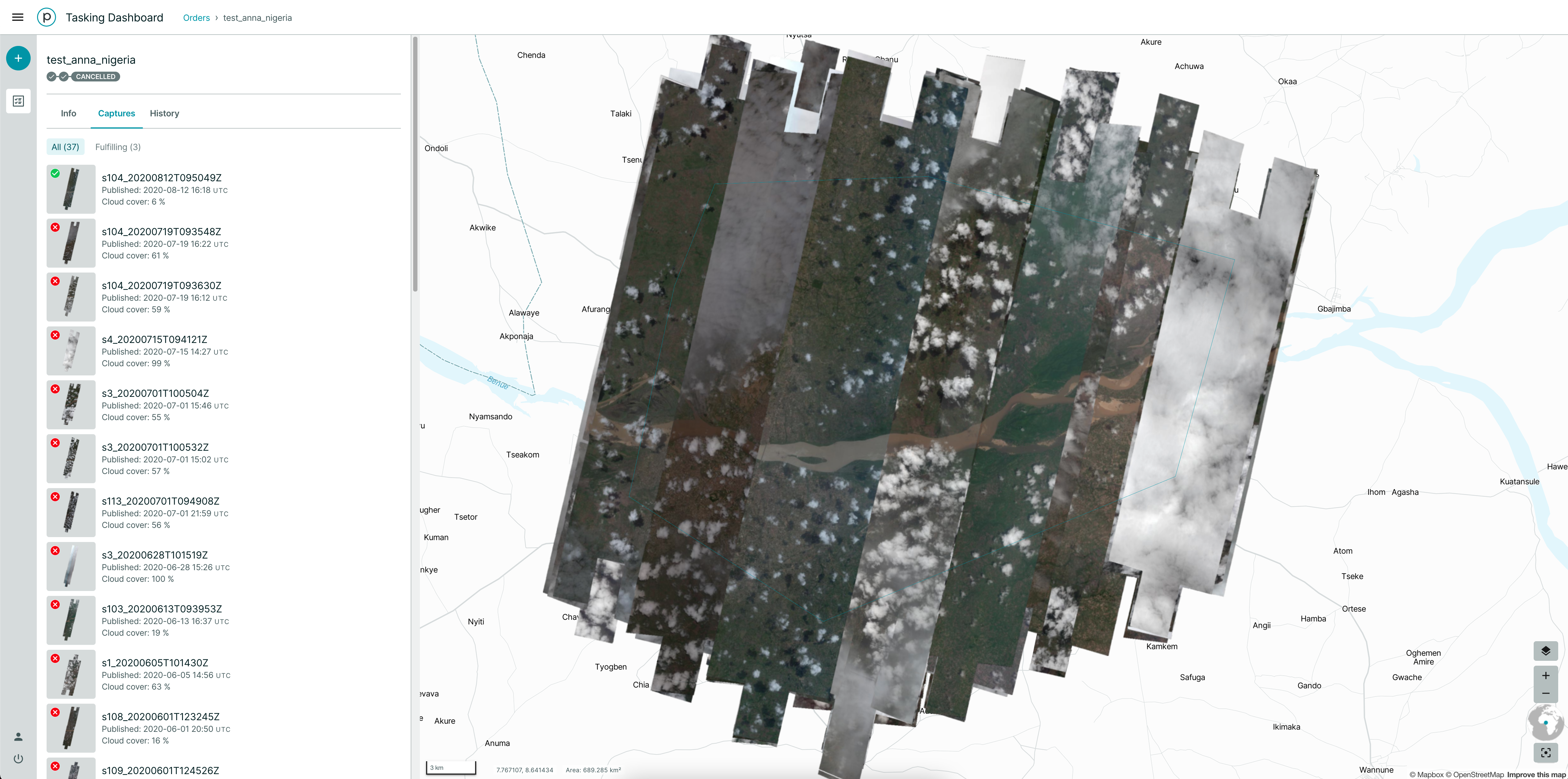
The Order Detail View now shows a quick filter to only show fulfilling images and furthermore presents all images stacked on top of each other on the right side.
December 17, 2020
The "active" Subscriptions API status has been renamed to "running", to reduce confusion upon future release of the backfill subscriptions capability. More details on Subscription Statuses are available here: https://developers.planet.com/docs/subscriptions/#subscription-status
Pagination has now been added to the GET Subscriptions endpoint. You can see a sample response in our API Reference here: https://developers.planet.com/docs/subscriptions/reference/#operation/getSubscription
December 15, 2020
Disabled sorting/ordering functionality on calculated fields: some fields can't be (plausibly) sorted, so users are no longer able to click the table header on these fields / columns.
December 14, 2020
New ✨
- Users with access to SkySat imagery can now order it for Hosted Analysis.
- Currently Imagery Enhancement is not available for these items.
- If you have ordered imagery for Hosted Analysis you can now move the items to a different or new folder.
Improvements 🙌🏻
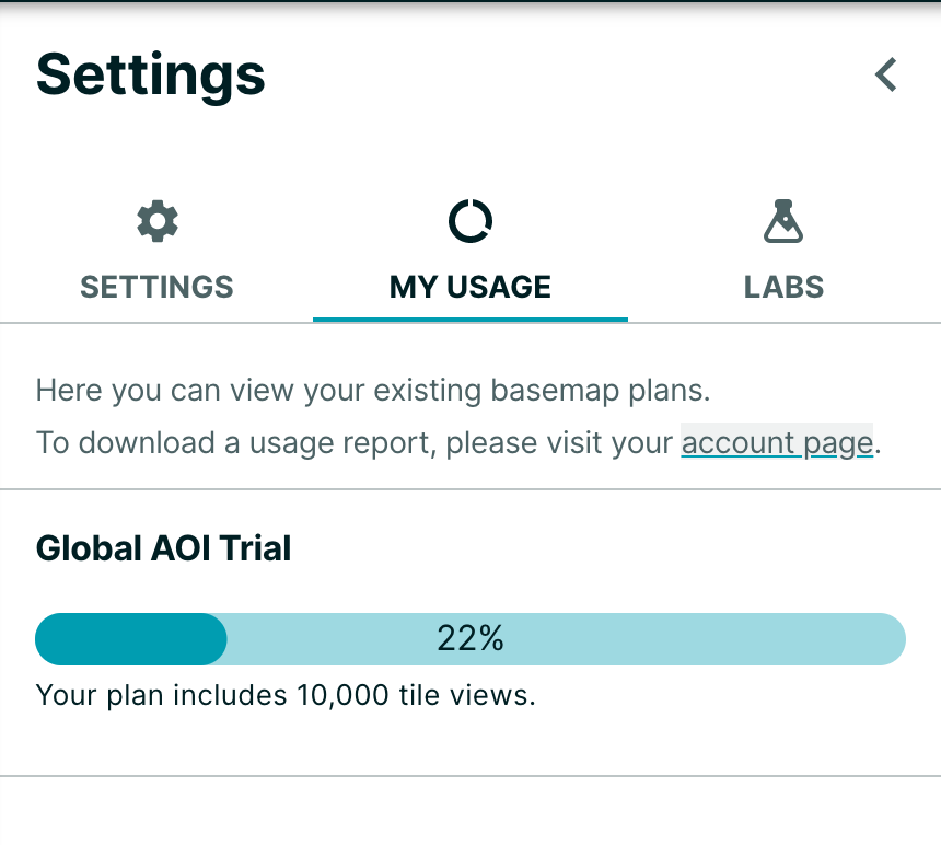
- We've improved the way we display your basemap tile view usage. We will no longer display the usage bar, but will notify users when they are almost out of quota at approximately 80% consumption and when they have completely run out. There is also a new "My Usage" tab to view usage (access via Settings Panel).
Bug Fixes 🐛
- Fixed an issue where typing into the filters number fields was not working as expected.
- Fixed an issue where the layers displayed on the map were not ordered as expected.
- Fixed an issue when searching by scene id was not returning results due to an incorrect date filter.