This section overviews the Planet Explorer imagery search options. You can search for the latest imagery over your area of interest by panning and zooming to the location, uploading a GEOJSON file for your AOI, or drawing a shape on the map.
Using the Search Bar
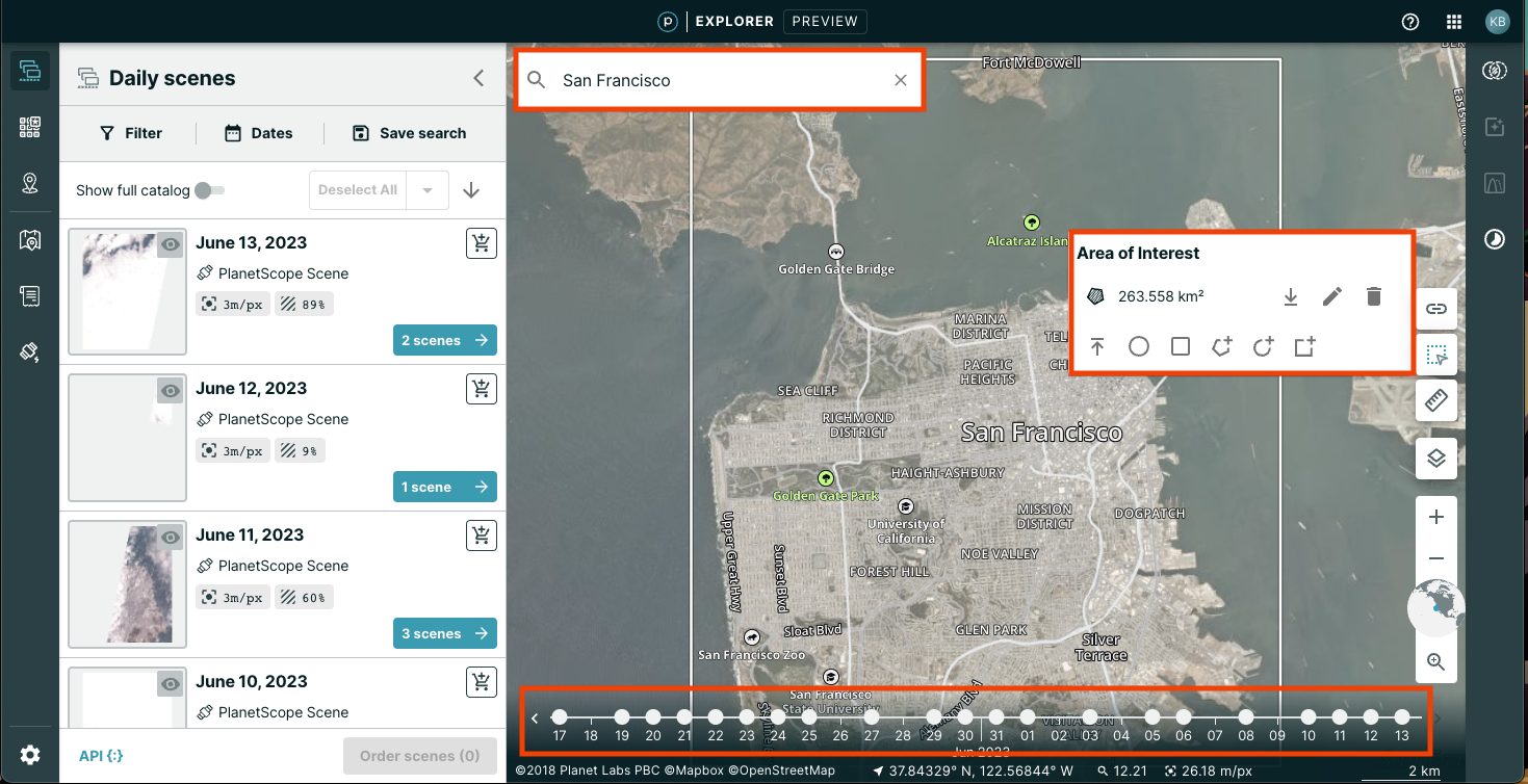
You can search for any location or a specific area of interest (AOI) by using the search box (similar to a search engine) located at the top left of the page. Type a location in the Search Bar. The map view zooms to that location and an Area-of-Interest (AOI) and a bounding box appears in the map. After you have a bounding box drawn, the search results appear in a panel on the left side of the page.
Creating an Area of Interest (AOI) on the Map
You can search for imagery by specifying an area on the map, either by drawing a geometry or uploading a GEO file. Supported file types include shapefile, GeoJSON, JSON, Keyhole Markup Language (KML), Well Known Text (WKT), GPX, DBF, SHX, PRJ, and ZIP files.
The map tools are available on the bottom right corner of the page. Hover over the Area-of-Interest (AOI) icon to view a tooltip to Draw or upload a geometry. Click the tool to view the options menu to create an AOI. The tooltip changes when you float over each icon in the group.
The following tools are available:
- File importer uploads a geo file into Planet Explorer. Click the Upload Tool to open a file system browser window and navigate to your file. You can upload more than one file to Planet Explorer, but if multiple polygons are found, Planet Explorer automatically simplifies the shape of your geometry. Supported file types include shapefile, GeoJSON, JSON, Keyhole Markup Language (KML), Well Known Text (WKT), GPX, DBF, SHX, PRJ, and ZIP files.
- Constrained Circular AOI draws a circle with a maximum area of 50,000 sq. km. The area varies by the latitude of the center coordinate.
- Constrained Rectangular AOI draws a rectangle with a maximum area of 50,000 sq. km. The area varies by the latitude of the center coordinate.
- Custom AOI draws a polygon of your choice.
- Circular AOI draws a circle of any size.
- Rectangular AOI draws a rectangle of any size.
Note
When you click a tool, the active tool changes to the color teal.
Selecting on the Time Slider & Using the Imagery Picker Tools
If you select a Basemap or create a search for imagery, a timeline slider bar appears at the bottom of the page. The dots in the slider indicate time intervals.
Filter Options
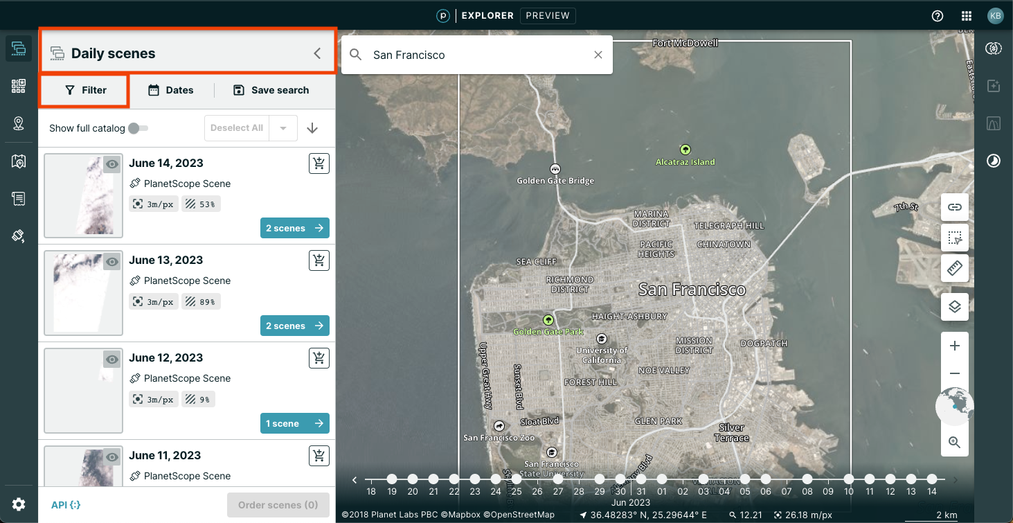
After searching for a location using the search bar or AOI tools, your search results will show under a header that states Daily scenes. Under this header, there are tabs that show Filter, Dates, and Save search. Click on Filter to access your filter options.
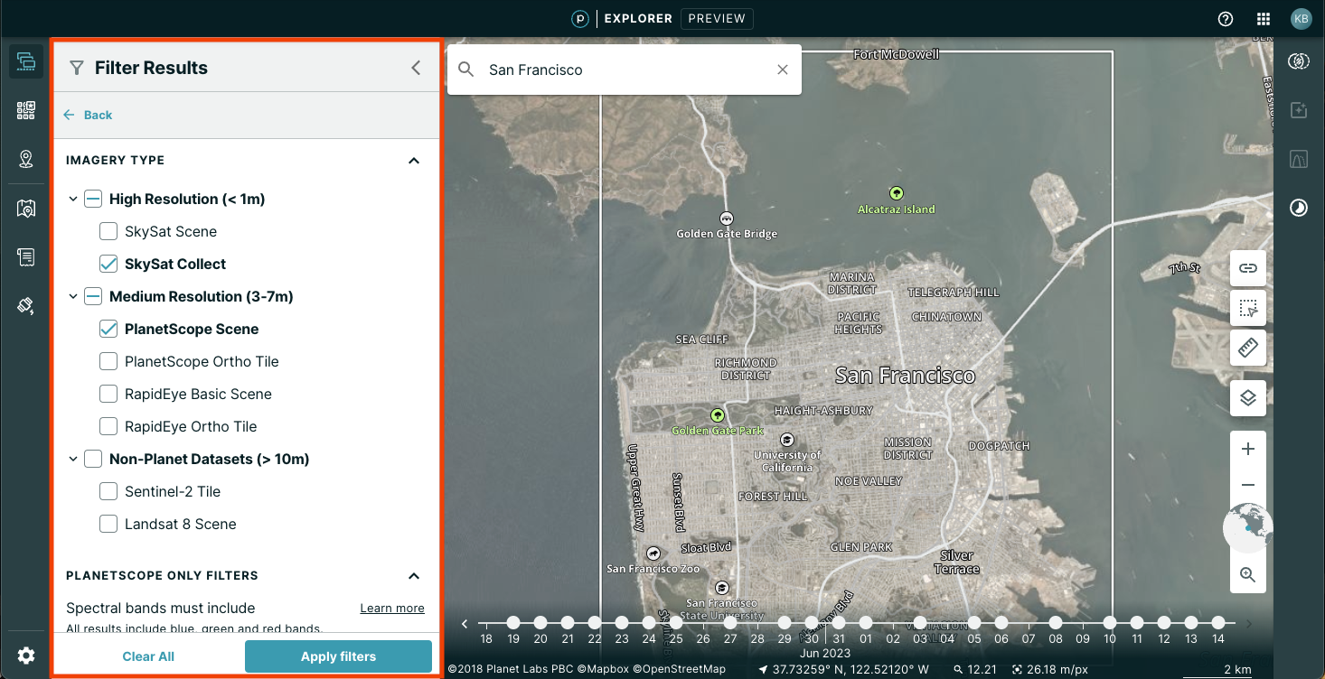
Filter options give the opportunity to filter results based on Imagery type, Planetscope only filters, Environmental conditions, and Advanced filters, such as showing images that are preview only for your access level. Scroll down to see all available filter options.
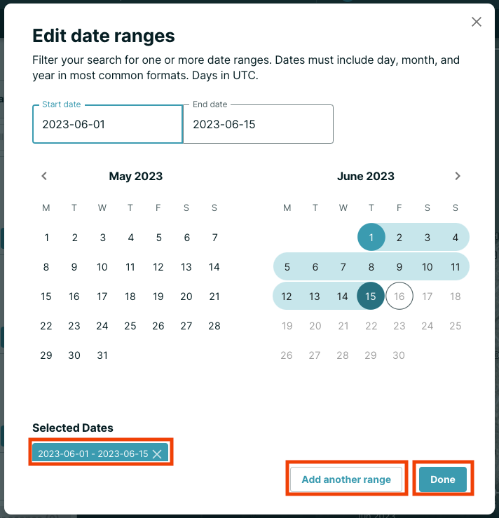
Date Ranges
The second tab under Daily scenes is Dates. Click this tab to select the dates that you wish to search.
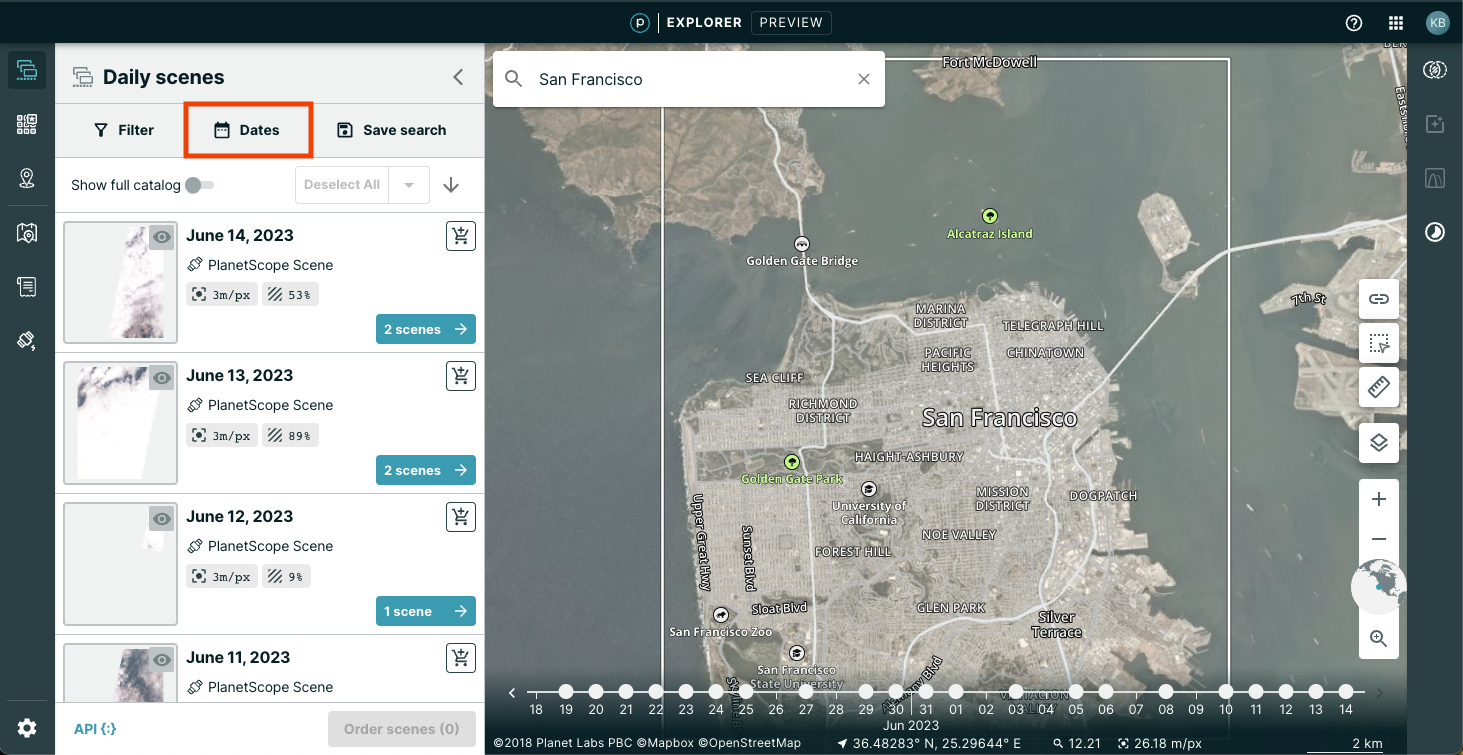
Clicking the Dates tab allows you to edit your date range(s). Select the beginning and end dates of the range that you are searching. You may select more than one date range by clicking the Add another range button. Each of the date ranges that you have selected show under the calendar. You may deselect a date range by clicking the X next to that date range. After all of the desired dates have been selected, click Done to complete this option.
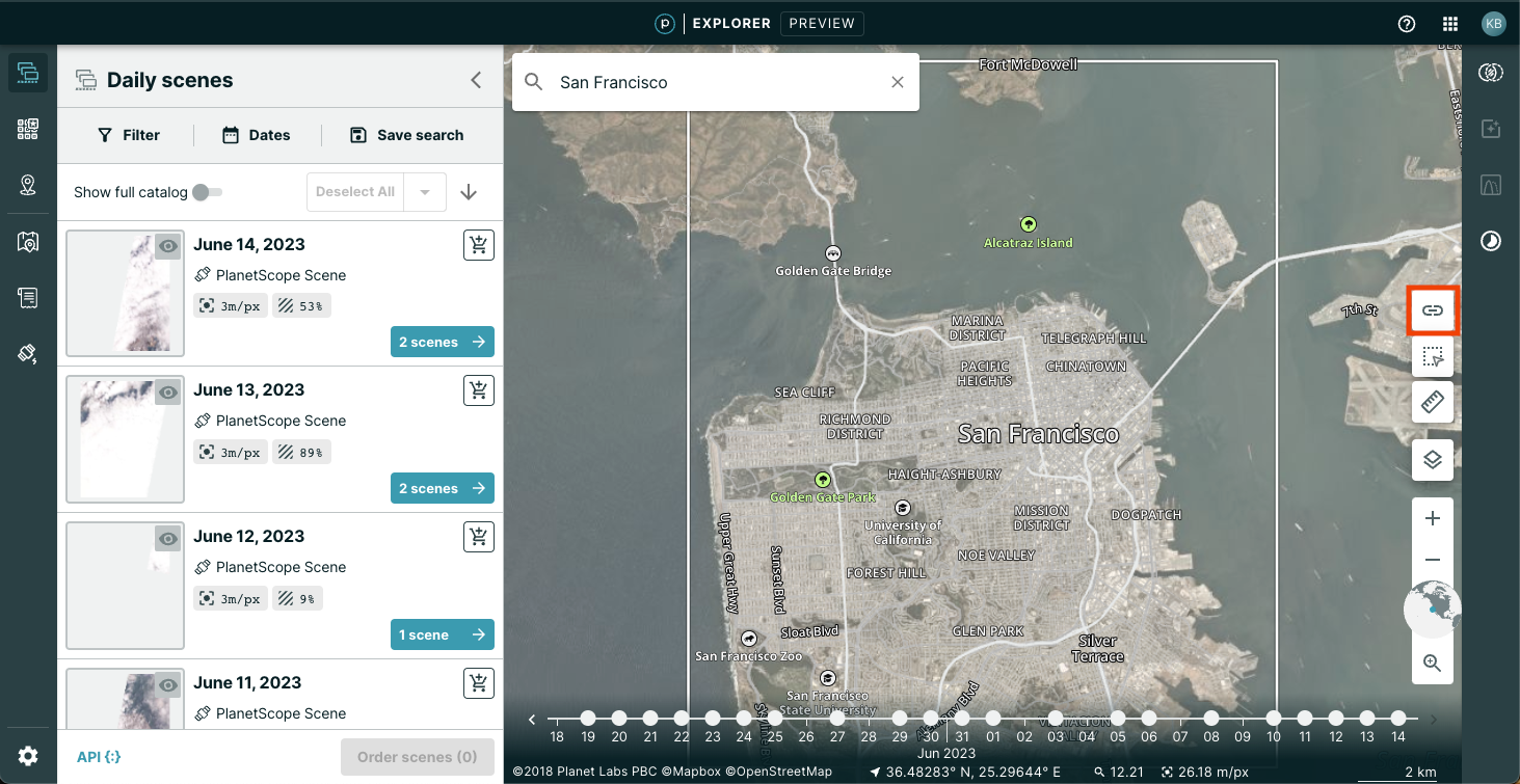
Sharing Your Session
If you want to share your session, click the Share this Session icon on the right side of the map. Click Copy to copy and share the link. Anyone with this link can view your entire session: your area of interest, your search filters, and your current selections.
We are continually working to improve our technical documentation and support. Please help by sharing your experience with us.